
On this page
Madeira's walking has changed more in the last two years than in the previous fifty, and almost none of the change is about the paths themselves. The trails are still there. What is different is that you now pay for them, you book a time slot before you arrive, one of the famous routes only runs in one direction, and a helicopter rescue in the wrong place comes with an invoice.
Most guides to the levadas are still describing the island as it was in 2023. This one is about the island as it works now: what each walk costs, what is genuinely open, which one to pick when the weather is bad, and the physical facts the official signs give that the listicles leave out.
What you pay, and how the booking actually works
Since 1 January 2026 every classified trail in Madeira, the ones signed PR followed by a number, carries a charge and requires a booking.
| Ticket | Standard price | Through an operator with an IFCN agreement | Under 12 |
|---|---|---|---|
| One trail (except PR1) | 4.50 € | 3.00 € | free |
| PR1 in full, including PR1.1, PR1.2 and PR1.3 | 10.50 € | 7.00 € | free |
| PR1 as far as Miradouro da Pedra Rija only | 4.50 € | 3.00 € | free |
| One day, two or more trails, not PR1 | 9.00 € | 6.00 € | free |
| Three days, not PR1 | 22.50 € | 15.00 € | free |
| Seven days, not PR1 | 52.50 € | 35.00 € | free |
Four things about this system trip people up, and all four are stated by IFCN itself.
You can only book online. The single legal channel is the regional government's SIMplifica portal. IFCN puts it in capitals: bookings and payments are made exclusively online, and none are taken at IFCN offices or anywhere else. There is no machine at the trailhead and no kiosk in the car park. If you drive to Rabaçal without a booking, you have driven to Rabaçal for nothing.
It is a time slot, not a ticket. The day is divided into entry windows, each with its own capacity, and a window locks once it fills. Capacities are held separately for visitors, residents and tour operators and cannot be swapped between them. There is about fifteen minutes of tolerance either side of your slot.
The multi day passes are not free access. This is the most misreported thing about the whole scheme. IFCN's own FAQ answers it in capitals: no, the 1, 3 and 7 day tariffs do not give you free access, and you must still book every single walk in advance. The pass buys a lower unit price and nothing else. You cannot even buy one directly. You pick your trails and the system works out the cheapest tariff that covers them.
Refunds barely exist. You get your money back only if IFCN itself closed or restricted the trail on your date. Rain, illness, a cancelled flight, booking the wrong day or the wrong trail: all forfeit the fee. Claims go in within ten working days and are paid by bank transfer only.
Residents of Madeira walk free with a resident card, and so do children aged 12 and under, but both still have to be registered on the booking.
The trails, and what the official numbers actually say
These are IFCN's own figures from the trail panels, which is the regional government stating the distance and time on the sign at the trailhead.
| Trail | Distance | Official time | Altitude range | Character |
|---|---|---|---|---|
| PR1 Vereda do Areeiro | 6.1 km | 3h00 | 1542 to 1862 m | The ridge walk. Tunnels, torch, one way |
| PR1.2 Vereda do Pico Ruivo | 2.8 km each way | 1h30 | 1592 to 1862 m | The easy way to the island's summit |
| PR6 Levada das 25 Fontes | 4.3 km each way | 3h00 | 964 to 1288 m | Laurel forest to a waterfall lagoon. Vertigo section |
| PR6.1 Levada do Risco | 3 km | 2h00 | 1000 to 1288 m | Easy. Shares its start with PR6 |
| PR9 Levada do Caldeirão Verde | 8.7 km each way | 6h30 | 872 to 1020 m | Four tunnels, torch, 110 m waterfall |
| PR8 Ponta de São Lourenço | 4 km each way | 2h30 | 23 to 126 m | Treeless sea cliffs on the dry eastern tip |
| PR11 Vereda dos Balcões | 1.5 km each way | 1h30 | 870 to 880 m | The genuinely easy one |
| PR13 Vereda do Fanal | 10.8 km | 4h00 | 1130 to 1420 m | Long, gentle, and usually in fog |
Two corrections worth carrying into your planning, because the numbers circulating online contradict each other for a reason.
PR9's official 8.7 km does not end at Caldeirão Verde. The signed route runs Queimadas to Caldeirão Verde and on to Caldeirão do Inferno, and the 6h30 covers all of it. The walk most visitors actually do, turning round at Caldeirão Verde, is about 6.5 km each way. The extension is a further 2.2 km with a steep climb and more tunnels, which IFCN describes as physically more demanding.
Nobody publishes cumulative ascent. IFCN's sheets give maximum and minimum altitude and nothing else. Any "1,100 m of climbing" figure you read for PR1 comes from a hiking app, not from the island's forestry authority.
And one that will save you a wasted booking: the popular Levada Nova loop at Ponta do Sol is not a classified trail at all. It is not in IFCN's register, it has no official distance, no fee, no signage and no closure reporting. The official PR7 Levada do Moinho is a completely different levada in the far northwest, and it is currently closed.
The rule that should decide your day
This is the most useful thing in this guide, and it comes from a University of Madeira paper rather than a tourist board.
Orographic cloud sits on Madeira between 800 and 1,600 metres for more than 200 days a year.
Line that band up against the trails and your day plans itself:
- Above 1,600 m you are usually above the cloud. Pico do Arieiro is 1,818 m and Pico Ruivo 1,862 m, so the whole PR1 and PR1.2 ridge sits over the top of it. On a grey morning in Funchal the peaks are often in sunshine, looking down on a floor of cloud.
- Between 800 and 1,600 m you are usually inside it. That is exactly where the laurel forest walks live: Rabaçal and 25 Fontes at 964 to 1,288 m, Fanal at 1,130 to 1,420 m, Caldeirão Verde at 872 to 1,020 m, Balcões at 880 m. For forest walking, the fog is the point rather than the problem.
- Below 800 m you are usually under it. PR8 Ponta de São Lourenço tops out at 126 m on the dry eastern tip and is the reliable low option.
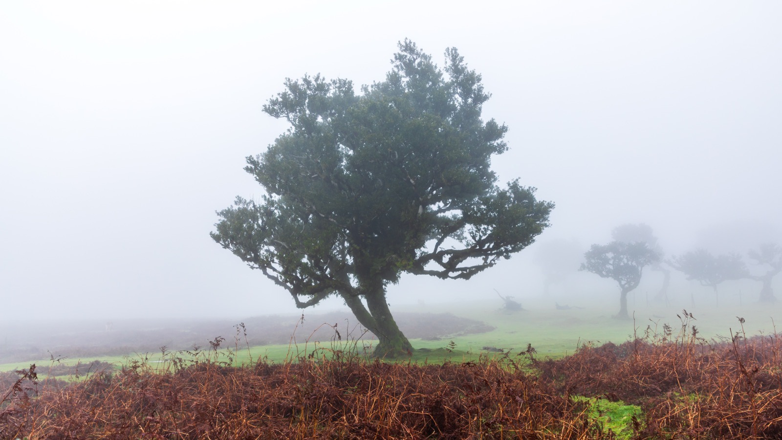
So when the cloud is down over the capital, go up or go down, not into the middle. And when you want the Fanal photograph everyone has seen, of ancient trees in fog, remember that fog is the ordinary state of that altitude rather than a lucky break.
The same paper explains why the north of the island is wetter than the south at the same height: the trade winds come from the northeast, and the island is an east to west barrier almost perpendicular to them. Madeira's wettest weather station, Bica da Cana at 1,580 m, records 2,966 mm a year.
PR1: one way, and it does not open until 08:00
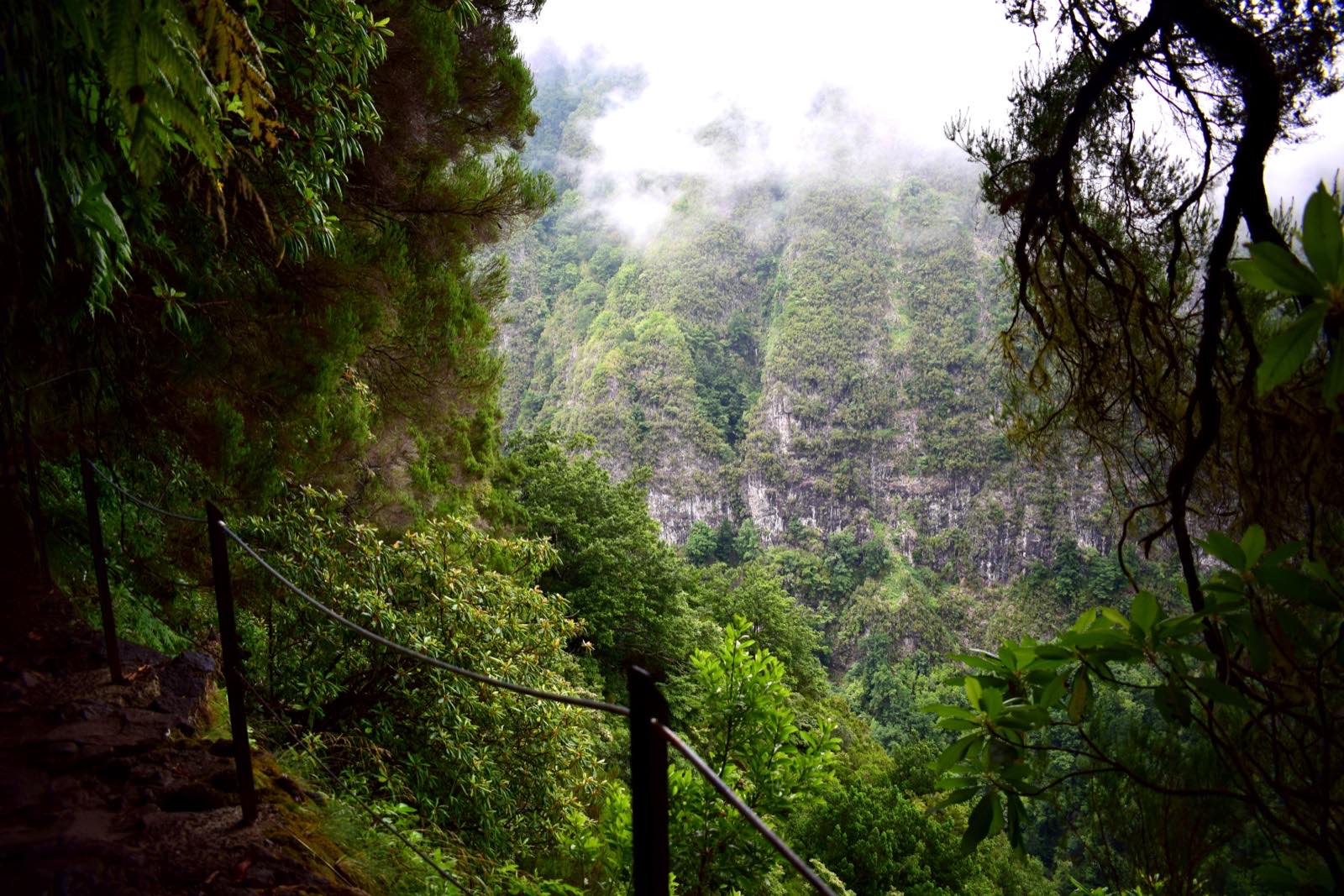
The Pico do Arieiro to Pico Ruivo traverse reopened in full on 1 May 2026 after a long closure, and since 26 June it has run every day of the week. But it is not the walk it used to be, and two changes catch people out.
It only goes one way now. Between Pico do Arieiro and Miradouro da Pedra Rija you can walk in both directions. Beyond Pedra Rija, as far as Pico Ruivo, it is strictly one way in the Arieiro to Ruivo direction. You cannot walk back. You come down either by PR1.2 to Achada do Teixeira or by PR1.1 to Ilha, and IFCN says plainly that walkers are responsible for their own transport and that it takes no responsibility for getting you back to Pico do Arieiro.
Since neither Achada do Teixeira nor Ilha has a bus, that means a second car, a driver who does not walk, a taxi booked in advance, or a guided group that runs its own transfer. The trail panel prints the taxi numbers itself.
You no longer cross Pico das Torres. There were two variants. The eastern one over Pico das Torres is closed, leaving the western route through the tunnels. Any description that has you climbing the rock staircase past Torres is out of date.
It opens at 08:00. The regional government stated in June 2026 that access to the authorised routes between Pico do Arieiro and Pico Ruivo always begins at Pico do Arieiro, open to the public from 08:00. Midsummer sunrise in Madeira is around 06:15, so you can absolutely drive up and watch the sun come over the cloud from the viewpoint. You just cannot start walking the ridge while you do it. Those are two different plans, and nearly every guide runs them together.
Take the torch instruction literally. The official sign says there are tunnels en route, carry a torch, carry drinking water, expect the weather to change, and bring warm clothing. It also carries the single best sentence the island's forestry service has ever written about its own trails: the paths are not dangerous, but they can disguise fatal cliffs hidden by vegetation.
One small thing to look out for at the start: the Ninho da Manta belvedere, a few metres from the trailhead, is the only known breeding site in the world of Zino's petrel, which IFCN calls the most endangered seabird in Europe.
25 Fontes and Rabaçal: two separate payments
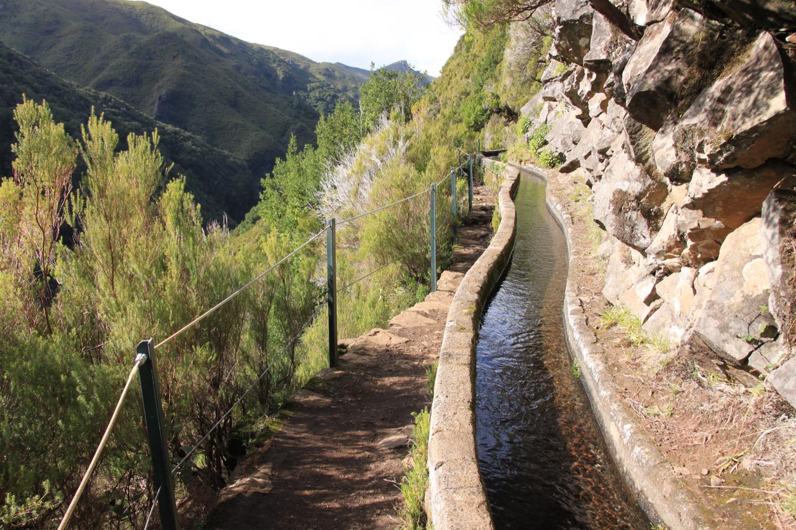
PR6 is the second most walked trail on the island, with 29,157 visitors recorded over a five month monitoring period, and it has the most confusing access arrangement of the set.
Both PR6 and PR6.1 start on the ER105 and drop to the Rabaçal forestry house. That descent is 2 km of paved road, and the Câmara Municipal da Calheta runs a minibus down it: 5 euros one way, 8 euros return, every day from 10:00 to 18:00.
That fare is a municipal charge and has nothing to do with your trail ticket. The 4.50 euro IFCN fee and its timed slot are booked online in advance; the minibus is paid on the day to the council. You pay both, and only one of them can be booked ahead.
PR6 is also one way now, though in a gentler sense than PR1: you walk out along the levada to the 25 Fontes lagoon and return by the alternative Bypass path, which reopened after rebuilding.
The vertigo warning here is unusually precise, which makes it useful. The official sign says PR6 can cause vertigo and tells you not to put your weight on the protection railings, and it identifies the one way section as running between km 3.3 and km 4.1. That is an 800 metre stretch, not the whole walk. If someone in your group is uneasy about exposure, that is the part to prepare them for, and PR6.1 Levada do Risco branches off before it.
Caldeirão Verde: four tunnels, and bring the torch
PR9 is the classic laurel forest walk and the one where the official warning matters most. The sign says: carry a torch, there are tunnels along the path; the path may be slippery, so wear non slip footwear; danger of vertigo. There are four unlit tunnels cut through rock.
The levada itself dates from the 18th century, and the walk ends at a lagoon fed by a 110 metre waterfall. If you continue to Caldeirão do Inferno you add 2.2 km of steep climbing and more tunnels through what IFCN describes as a very narrow, deep river gorge.
PR9 reopened on 29 May 2026. The accessible section, PR9.1 from Queimadas to Pico das Pedras, is a separate 1.9 km route designed as a path for everyone.
The honest easy ones
Not every walk here is an expedition, and two of them genuinely suit families, nervous walkers and anyone who just wants the forest without the drop.
PR11 Vereda dos Balcões is 1.5 km each way and the altitude range across the entire trail is ten metres. The official caution mentions changeable weather and a slippery surface, and nothing else: no vertigo warning, no tunnel, no torch. It finishes at a viewpoint over the Ribeira da Metade valley with Pico do Arieiro, Pico das Torres and Pico Ruivo lined up on a clear day, and the Fajã da Nogueira hydroelectric station below, which is a neat reminder that these channels still generate electricity.
PR6.1 Levada do Risco is two hours to a waterfall that drops in a single vertical line down dark rock, which is where its name comes from. It shares its first section with the 25 Fontes route and then splits off before the exposed part.
PR8 Ponta de São Lourenço looks easy on paper at 126 metres of maximum altitude, and it is easier than PR1, but do not read it as enclosed. It is a treeless, wind blasted basalt peninsula with sea cliffs on both sides, and the official warning is specifically that the ground near the cliff faces is unstable in many places. It is also the busiest trail on the island, with 32,445 visitors over the same monitoring period.
What a levada actually is
Portugal's own submission to UNESCO puts the network at 3,100 km of channels on an island of 742 km², of which about 80 km runs through tunnels. For comparison, Madeira is 55 km across at its widest.
They were begun in the first quarter of the 15th century, within a decade or two of settlement, to irrigate sugar cane, and by the second half of that century the water they carried had made Madeira one of Europe's largest sugar exporters. Where the rock was too hard to cut, the early channels were wooden gutters made of til and barbusano, the same laurel trees the walks now pass through.
For four centuries they were private works, built by landowners or by associations of heréus, co-owner farmers each holding a share of the water. The men who built them were the rocheiros, who worked hanging from ropes tied to trees and rock, cutting the channel from baskets suspended over the drop. The UNESCO submission does not soften what that cost: many lost their lives. Their reputation travelled. The Governor of India wrote to Lisbon proposing to bring the men who cut the waters through the mountains of Madeira out to Egypt, to divert the Nile away from Cairo.
The first publicly financed levada, the Levada Velha do Rabaçal, took from 1835 to 1860 to build.
And they are not a museum. Channels above 1,000 metres feed hydroelectric power houses; the water drops about 400 metres through the turbines and is then distributed for irrigation lower down. By 1967 the system irrigated 20,000 hectares, close to all the island's arable land. The path you walk on is a maintenance path for working infrastructure, which is why it is a metre or two wide and why it clings where it clings.
The forest they run through, the Laurissilva, was inscribed by UNESCO in 1999. It covers about 15,000 hectares and is the largest surviving fragment of a laurel forest type that covered much of southern Europe 15 to 40 million years ago. UNESCO believes roughly 90% of it is primary forest, with individual trees possibly over 800 years old, growing before anyone settled the island. It holds at least 76 vascular plant species found nowhere else and more than 500 endemic invertebrates.
Getting there without a car
| Trailhead | Bus? | Detail |
|---|---|---|
| Baía d'Abra (PR8) | Yes, roughly hourly | Line 113 from Funchal via Machico and Caniçal, seven days a week. The one trail here that is genuinely easy without a car |
| Ribeiro Frio (PR11) | Yes | The Santana line, several arrivals through the day and a Sunday service. A real bus day trip |
| Pico do Arieiro (PR1) | A dedicated service | Horários do Funchal runs it from the cable car terminus at 06:00 and 13:30, 3 euros per trip, tickets on board only, every day except 25 December |
| Rabaçal (PR6, PR6.1) | No | Not on any line. Taxi, transfer or guided trip, then the municipal minibus for the last 2 km |
| Achada do Teixeira (PR1.2, and the PR1 exit) | No | Taxi or transfer only |
| Fanal, Paúl da Serra (PR13) | No | Not served |
Which produces an awkward result for the island's most famous walk: you can get to the start of PR1 by bus and you cannot get back from the end of it. The route is one way, and neither exit has a service. By public transport, PR1 is half a plan.
What it costs if it goes wrong
Entering a trail that is temporarily or permanently closed is an offence under the 2022 regional trail law, with fines from 250 to 2,500 euros for an individual and from 500 to 10,000 for a company. The same provision covers damaging trail infrastructure or signage, taking a vehicle onto a trail, and dumping waste. Enforcement sits with IFCN's forest police and nature wardens.
Then there is the part almost nobody knows about. Since January 2025, air rescue in Madeira is charged. The regional tariff applies to helicopter rescues carried out off the classified trail network, or on a classified trail that is closed, where the closure has been properly published and signposted.
| Charge | |
|---|---|
| Launching the aircraft | 753.25 € |
| Flight time | 7.50 € per minute |
| Rescue crew | 105 € each, up to two |
Residents of Madeira are exempt on production of their resident card. Everyone else is not. Read that alongside the closure list and the reason for both becomes obvious: the trail IFCN has publicly closed is exactly the trail the invoice is written for.
Civil Protection has recorded around 68 accidents on levadas and trails needing a rescue callout since the start of 2022. It publishes no fatality count, and neither will we.
Picking your walk
The monitoring data says more about how to plan a day here than any advice column. Six trails take 76% of all the walking on the island: São Lourenço, 25 Fontes, PR1, Pico Ruivo from Achada do Teixeira, Caldeirão Verde and Balcões. The busiest month is September, ahead of August and July. And the entry peak, across every monitored trail, is 09:00 to 11:00.
So: book an early slot or a late one, and you will have walked the same path as everyone else without meeting them.
If you want one walk, make it PR6 to 25 Fontes for the forest or PR1 for the ridge, and pick between them by looking up at the cloud. If you have an afternoon rather than a day, Balcões. If the forecast is bad everywhere, São Lourenço is under the weather rather than in it.
And if the transport logistics of a one way ridge walk are the thing standing between you and PR1, that is exactly the problem a guided group solves. Operators with an IFCN agreement also book at the reduced tariff, 7 euros instead of 10.50 for the full route, which takes some of the sting out of it. Turinity lists guided walks on 25 Fontes, Caldeirão Verde, Pico Ruivo, Fanal and the Pico do Arieiro sunrise, run by operators based on the island.
Whatever you book, check the IFCN status page the day before. It is updated continuously, sometimes daily, and a trail that was open when you paid can be closed for works by the time you arrive. In September 2026 the final stretch of PR1 shut on five separate days for boardwalk installation, with no bookings taken. That is not unusual here. It is how the network is maintained.
Frequently asked questions
Do you have to pay to walk the levadas in Madeira in 2026?
How do you book a Madeira trail, and can you do it on the day?
Are the 3 day and 7 day trail passes unlimited?
Is the Pico do Arieiro to Pico Ruivo walk open?
Which Madeira levada walk is the easiest?
Do you need a torch for the levada walks in Madeira?
Can you reach the Madeira trailheads by bus?
What happens if you walk a closed trail in Madeira?
Book one of these on Turinity
Sources
Walking trail notices: closures, works and the one-way regime on PR1. IFCN, IP-RAM (2026)